Thursday, December 6, 2007
People's Daily Online -- Tianjin Binhai New District: new engine of Bohai Bay-rim
People's Daily Online -- Tianjin Binhai New District: new engine of Bohai Bay-rim: "The Bohai Bay-rim economic region is made up of Beijing, Tianjin, Hebei, Shandong and Liaoning, the so-called 3+2 area. Covering 518,000 square kilometers, the area, with a population of 230 million, or 17.5 percent of the national total, generates gross product of 3.8 trillion yuan, 28.2 percent of the country's total. There is another view that Shanxi and Inner Mogolia are also part of the Bohai Bay-rim area. However, it is generally agreed that, unlike the Pearl River Delta or the Yangtze River Delta, the Bohai Bay-rim is a complex economic region, integrating three economic sub-regions, Beijing-Tianjin-Hebei, Shandong peninsula, and Liaoning peninsula."
Binhai area promises big growth
Binhai area promises big growth: "Infrastructure facilities will be strengthened to meet their growing needs. Tianjin is upgrading Binhai International Airport to a North China air hub: passenger volume is expected to surge from 2.15 million in 2005 to 6.5 million in 2010; and cargo shipments will jump from 96,000 tons to 500,000 tons during the same period, he said. The completion of an express train line by June 2008, just before the Beijing Olympic Games, will link the city to the capital with a half-hour ride. 'In the short run, the integration of air traffic service in Tianjin and Beijing will contribute to the Olympic Games; in the long run, it will make BNA into a transport centre in North China,' he said. At the ongoing National People's Congress annual session, Pi said he proposed building an oil reserve base in the area. For one thing, proven oil reserves in the Bohai Sea area are 3.2 billion tons, and Tianjin Port is being revamped for use of 300,000-ton oil tankers. In addition, oil pipelines have been laid from the port to many regions, he said. (China Daily 03/10/2006"
UT Library China Maps

(1971)
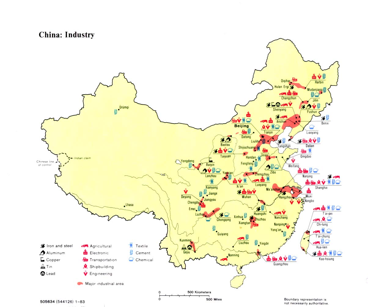
(1983)
The University of Texas has an interesting collection of China maps/infographics, like these two from 1971 (top) and 1983 (bottom), depicting various centers of industrial production. Interesting to see the concentration of activity in the East indicated by both maps. Urumqi's got 'cement' by 1983, but that's about it.
China Maps - Perry-Castaneda Map Collection - UT Library Online
Subscribe to:
Posts (Atom)